
Most first-time visitors walk through the Gallery of Maps in about eight minutes on their way to the Sistine Chapel. It’s a mistake, and one of the reasons a good guide slows the group down here. The corridor is 120 metres of the sharpest political geography the Renaissance ever produced: forty maps of the Italian peninsula, commissioned by a Pope who wanted to see his territory whole for the first time. Look up — the ceiling is arguably more spectacular than what’s on the walls.
This page is the plain-English guide to the Gallery: what it is, when it was built, what to look for as you walk it, and how to fit it into a normal Vatican Museums visit. If you want a licensed guide to walk you through room by room, our Vatican tours include the corridor at a sensible pace.
At a glance
- Where: Inside the Vatican Museums, on the standard visitor route toward the Sistine Chapel.
- Dimensions: 120 metres long, roughly 6 metres wide — one of the longest continuous corridors in the Museums.
- What’s inside: 40 topographical maps of the Italian peninsula, plus 51 painted and stucco-framed ceiling panels.
- Built: 1578–1580, frescoed in under two years.
- Commissioned by: Pope Gregory XIII.
- Ticket: Included with the standard Vatican Museums entry — no separate ticket.
What the Gallery of Maps is
The Galleria delle Carte Geografiche was commissioned by Pope Gregory XIII in the late 1570s and built between 1578 and 1580 by the architect Ottaviano Nonni, known as “Il Mascherino”. Its purpose was straightforward and unprecedented: to depict the entire Italian peninsula, region by region, as a single visual whole. Italy in the 1570s was politically fragmented — city-states, duchies, Spanish-controlled south, papal territories in the middle — and no ruler had ever tried to see it whole in a single space.
The Vatican Museums put it plainly on their own page: the gallery was “revolutionary in its choice to represent Italy, at the time divided into many political entities, as a geographical, historical, religious and cultural unit for the first time.” It was, in effect, an argument painted on a wall — that Italy might be understood as one thing, at least under the papacy’s spiritual authority.
Egnazio Danti and the design
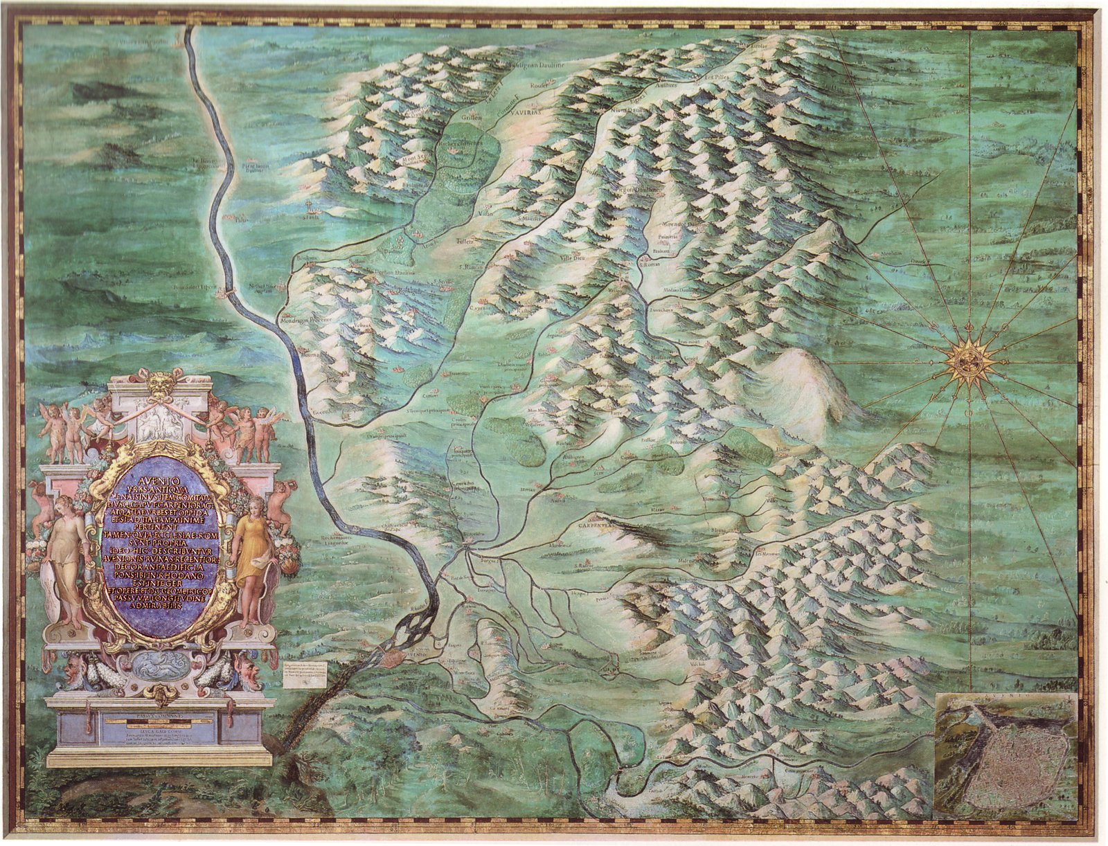
The whole programme was designed by Egnazio Danti, a Perugian Dominican who was also cosmographer, astronomer and mathematician — one of those Renaissance-scholar Dominicans whose day job included papal court advisor. Danti chose which regions were mapped, in what order, and how the geography was to be paired with historical episodes and biblical themes on the ceiling above.
The actual painting was executed by a team of artists coordinated by two of the best in Rome at the time: Girolamo Muziano and Cesare Nebbia. Between them, and the Brill brothers among others, they finished the frescoes in under two years — a remarkable pace for a corridor of this scale.
How the maps are organised
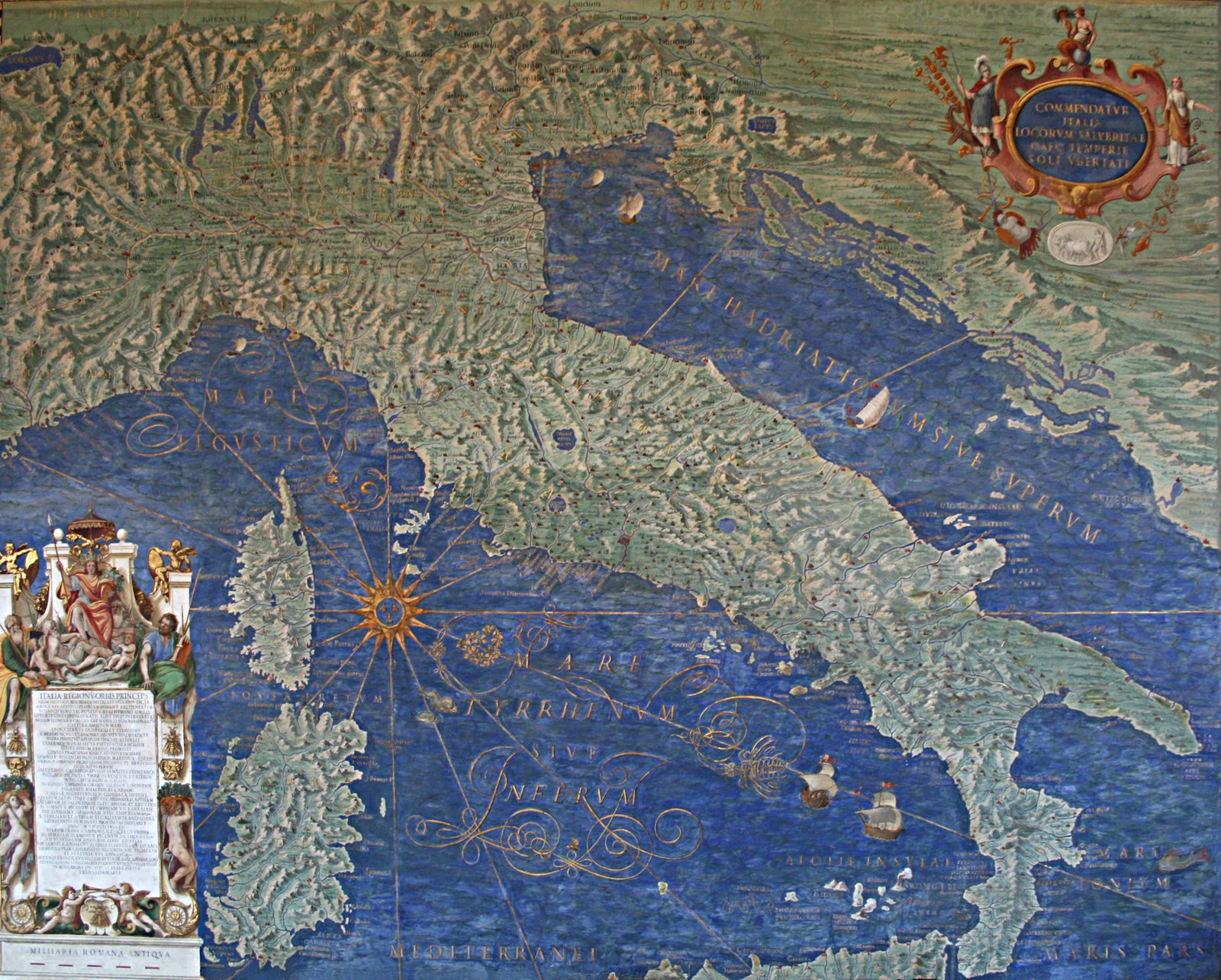
There are forty maps in total. Danti’s clever spatial trick was to use the corridor itself as a virtual axis of Italy: the Apennine mountains run down the middle of the peninsula, and he put the Apennines down the middle of the corridor. Stand at one end, look to the walls:
- The wall on the Belvedere Courtyard side shows the regions on the Tyrrhenian/Ligurian side of the Apennines — the west coast of Italy, from Liguria in the north down through Tuscany, Lazio, Campania, Calabria.
- The wall opposite shows the Adriatic-facing regions — Piedmont, Lombardy, Veneto, Emilia-Romagna, Marche, Abruzzo, Puglia.
- Each of these two walls has 32 regional maps, roughly aligned north to south so you walk from north Italy at one end of the corridor to south Italy at the other.
Then there are eight additional narrow maps at the ends of the gallery: the Siege of Malta (1565) and the Battle of Lepanto (1571) — the two great naval defeats of Ottoman expansion into the western Mediterranean, both fresh in memory when Gregory XIII was pope — plus panels showing the islands of Elba and the Tremiti, and detailed port views of Civitavecchia, Genoa, Venice and Ancona.
The ceiling — don’t miss it
The corridor’s ceiling is 51 individually framed panels set into gilded stucco, and it’s arguably a stronger single piece of art than any individual map on the walls. Each panel above a regional map depicts a scene from Church history, an Old Testament event, or the life of a saint associated with the region below. Danti chose them deliberately — the geography on the wall pairs with a memory of the miraculous, the martyrdom, the papal moment attached to that same landscape.
Two practical notes. First, most visitors never look up. Second, the stucco framing is what makes the corridor look so ornate — the gilding catches the natural light from the corridor windows, and on a bright morning the effect is spectacular. Take twenty seconds and look at the ceiling above the map that catches your eye. It changes what you notice about the map itself.
Which maps to point out
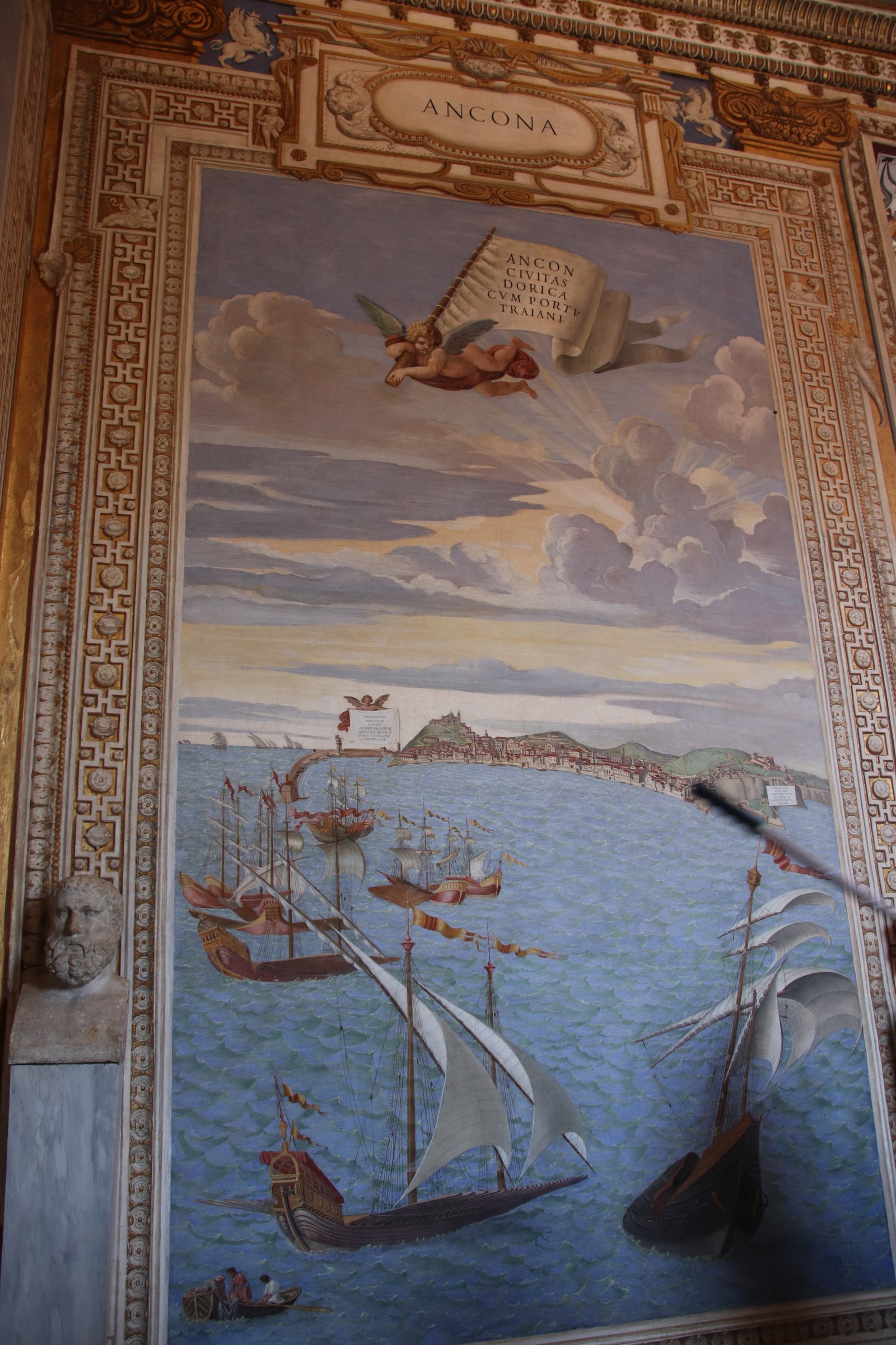
You could look at every map slowly and be there an hour. If you have ten minutes, we usually point out:
- The port views at the gallery ends — Venice, Genoa, Civitavecchia and Ancona. Painted as bird’s-eye views with each port’s characteristic geography exaggerated for legibility. Venice is the standout: you can see the Doge’s Palace, the shape of the lagoon, and the wooden bridges as they were in the 1570s.
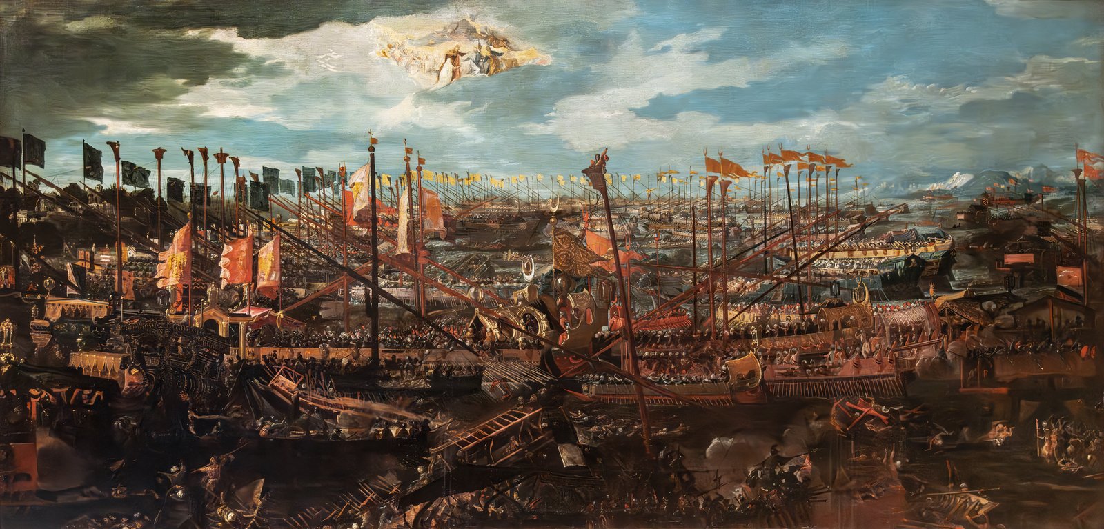
- The Battle of Lepanto panel — depicting the 1571 naval battle where a Holy League fleet defeated the Ottomans. It’s a piece of political triumphalism, but it’s also one of the most detailed period images of a Mediterranean sea-battle.
- The Siege of Malta panel — showing the 1565 defence of Malta by the Knights of St John against the Ottomans.
- The Rome map, on the Tyrrhenian side — you can identify the outline of the Vatican itself, the Colosseum, the Tiber, and see how much of the city was still open fields inside the ancient walls.
- The Battle of Metauro and Siege of Mirandola — historical scenes worked into the regional maps as vignettes. Look for tiny figures fighting battles inside the maps.
The 2016 restoration
The frescoes were restored across the early 2010s and the gallery reopened on 27 April 2016. Centuries of candle soot, incense residue and atmospheric grime had dulled the greens of the vineyards and the blues of the seas. The reveal was substantial — the then-director of the Vatican Museums, Antonio Paolucci, called the restored corridor “a prodigy of green and blue”.
What you’re looking at today, in other words, is roughly what a 16th-century visitor to the papal palace would have seen: the colours as they were meant to be, the gilding on the ceiling reflecting properly, the topographical detail sharp.
Where the gallery sits in the visit route
The standard Vatican Museums route — the one every day visitor and every guided tour follows — moves in one direction only. You enter, work your way through the Pio Clementino Museum’s ancient sculptures, then the Gallery of the Candelabra, then the Gallery of the Tapestries, then the Gallery of the Maps, then the Raphael Rooms, then the Sistine Chapel.
The gallery therefore sits about two-thirds of the way through the standard visit, right before the Raphael Rooms. Practically: if you arrive at the Museums for the 08:00 opening slot and walk at a normal pace, you’ll be in the Gallery of Maps around 09:00, in the Sistine Chapel by 09:30. If you slow down and give the corridor its due, add 15 minutes.
Practical tips
- Photos: Allowed without flash, and without a tripod. Handheld phone or camera is fine.
- Best light: Mid-morning, when the corridor windows are hit by direct sun. The gold in the ceiling really works then.
- Look up: Standing halfway along the corridor and looking straight up gives you the most complete view of the stucco framing.
- Accessibility: The corridor is level and step-free. Wheelchair users can enter the gallery on the standard barrier-free itinerary from the Museums entrance; ask staff at the door for the accessible route.
- Silence isn’t required here (that’s the Sistine Chapel). But it’s usually crowded — a guided small-group tour helps because the guide can find a quieter spot to talk you through the highlights.
FAQ
Do I need a separate ticket for the Gallery of Maps?
No. It’s inside the Vatican Museums and included in the standard Museums ticket. You pass through it on the standard visitor route toward the Sistine Chapel.
Can I take photos in the Gallery of Maps?
Yes, without flash and without a tripod. Handheld cameras and phones are fine throughout the Museums. The only place with a total photo ban is the Sistine Chapel further along the route.
How long should I spend in the Gallery of Maps?
Fifteen to twenty minutes to look at the maps properly and the ceiling above them. Most first-timers rush through in under ten and miss the ceiling entirely.
Who commissioned the Gallery of Maps?
Pope Gregory XIII, the same Pope behind the calendar reform of 1582. Construction took place 1578 to 1580 and the frescoes were completed in under two years by a team led by Girolamo Muziano and Cesare Nebbia, working from a programme designed by the Perugian Dominican Egnazio Danti.
How many maps are there?
Forty in total. Thirty-two regional maps of the Italian peninsula, aligned north to south along the corridor and arranged with Tyrrhenian-side regions on one wall and Adriatic-side regions on the other; plus eight narrow maps at the ends showing the Siege of Malta, the Battle of Lepanto, Elba, the Tremiti Islands, and the ports of Civitavecchia, Genoa, Venice and Ancona.
Is the Gallery of Maps wheelchair accessible?
Yes. The corridor is level and step-free, and the Museums offer a barrier-free itinerary that includes the gallery. Ask staff at the entrance for the accessible route.
When was the Gallery of Maps restored?
The most recent restoration finished with a formal reopening on 27 April 2016. Centuries of soot and grime had dulled the colours; the restoration reveal was substantial, and the greens of the Italian countryside and the blues of the seas are now much closer to what a 16th-century visitor would have seen.
Is the Gallery of Maps the corridor with the ceiling frescoes?
Yes. It’s the long corridor whose ceiling is 51 gilded stucco frames around individual painted panels of biblical and Church-history scenes. The ceiling is arguably as impressive as the maps below.
Which is more famous — the ceiling or the maps?
Both are the point. The maps are historically important because they were the first attempt to depict Italy as a single geographical whole. The ceiling is artistically the more spectacular achievement in the room.
Do I have to walk through the Gallery of Maps to see the Sistine Chapel?
Yes, on the standard visitor route. Everyone entering the Museums passes through the Gallery of Maps on the way to the Raphael Rooms and then the Sistine Chapel.
Plan your visit
If you’d rather have a licensed guide walk you through the corridor at a sensible pace — pointing out the ports, the Lepanto panel, the Rome map and the ceiling in one flow — browse our Vatican tours. Small groups, skip-the-line entry, licensed English-speaking guides. For a skip-the-line ticket without a guide, Vatican Museums tickets is the option. See also our Vatican Museums hours guide and the Vatican dress code.